Crohamhurst images
Sunday, June 1st, 2014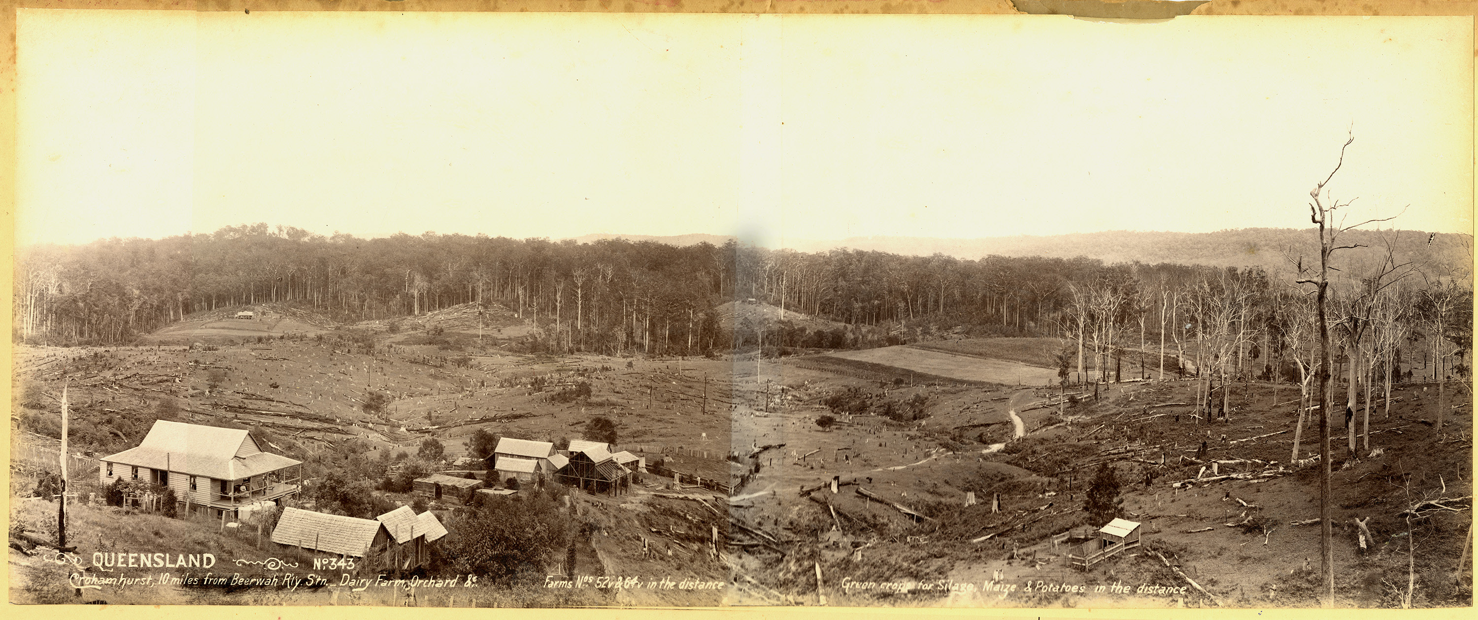
Two images that exemplify the impact of closer settlement on the environment in the 1890s. These images were taken by the Department of Agriculture and Stock photographer (Source: Queensland State Archives)
Thom Blake Historian

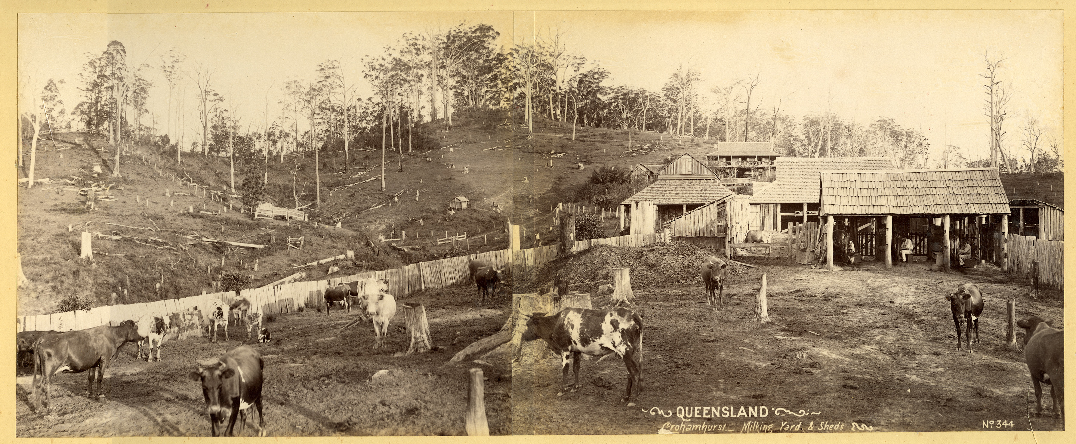
Two images that exemplify the impact of closer settlement on the environment in the 1890s. These images were taken by the Department of Agriculture and Stock photographer (Source: Queensland State Archives)
It is not uncommon to see next to rivers that flood frequently, posts or markers indicating flood heights in the past.
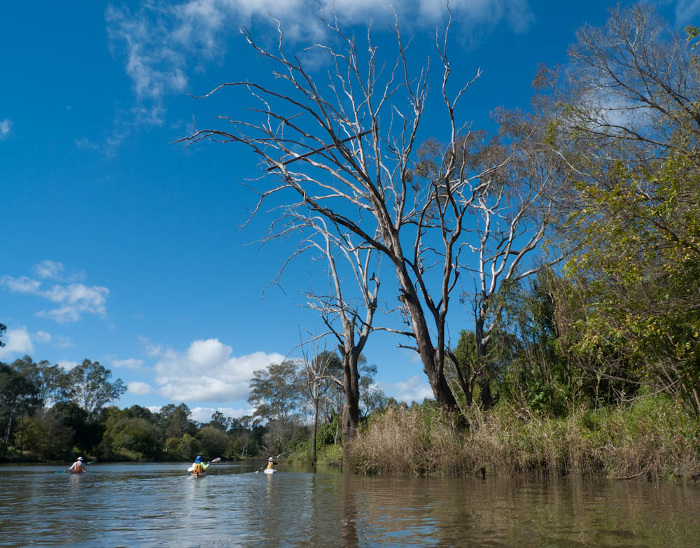
This is a flood marker with a difference. A piece of timber lodged in a tree next to the Bremer River that indicates the height of the flood in January 2011. This timber is about 19 m above the river. Viewed from normal river level in a kayak, it provides a striking sense of the height of the flood and enormity of water that is missed when viewed from above.
Queensland has experienced some of the most widespread and devastating floods since European occupation in the past two months. Arguably never before has the floods been so extensive in the extent of area inundated and the number of towns and cities affected.
But floods are not a rare occurrence in Queensland. Most towns and cities have all experienced serious and very damaging floods at some point in their history. Brisbane has had major floods in 1890, 1893 and 1974. Rockhampton had experienced major flooding on numerous occasions with the worst in 1918.
Surprisingly the impact of floods has not attracted little attention by historians. Certainly there is no definitive history of floods in Queensland and the general histories of Queensland only mention floods in passing. The most notable exception is Barbara Webster’s Marooned Rockhampton’s Great Flood of 1918 (2003). This publication provides a detailed analysis of the social, economic and political impact of the flood on Rockhampton and district.
There is a urgent need to research how floods have shaped Queensland. Some questions include:
Of course there are numerous other questions but certainly worthy of systemic research.